Contango Silver and Gold Inc. (NYSE American: CTGO) (TSX: CTGO) is pleased to announce an updated mineral resource estimate for its 100% owned Kitsault Valley Project located in Northwest British Columbia’s Golden Triangle. The updated MRE, prepared under Subpart 1300 of U.S. Securities and Exchange Commission Regulation S-K, has an effective date of September 11, 2026, and reflects a substantially revised geological interpretation supported by ~434,000 meters of drilling completed through the end of the 2025 program.
Highlights
Rick Van Nieuwenhuyse, the Company’s Chief Executive Officer, said, “This updated mineral resource estimate confirms what our drilling has been telling us all year – Kitsault Valley continues to grow, both in scale and in confidence. Our Indicated resource has increased 93% to just shy of 90 million ounces silver-equivalent, driven not just by more drilling but by a fundamentally improved geological understanding of both the Dolly Varden and Homestake systems. That’s a materially stronger foundation as we head toward an Initial Assessment. It’s also worth noting that none of our 2026 drilling – now well over 50,000 meters – is reflected in these numbers, meaning this update represents where the project stood before this year’s 50,000-meter drill program even began. We look forward to incorporating this new data into our 2027 resource update and then working on an initial mining plan for the district with completion of an Initial Assessment later in 2027. We are committed to continuing to deliver shareholder value by building the Kitsault Valley project into one of the premier primary silver mines in the Golden Triangle.”
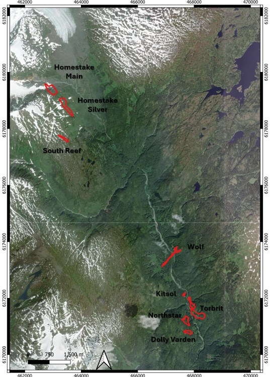
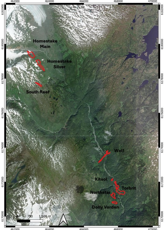
Figure 1. Location of the eight Kitsault Valley resource deposits (Homestake and Dolly Varden areas). Coordinates NAD83 / UTM Zone 9N.
To view an enhanced version of this graphic, please visit:
https://images.newsfilecorp.com/files/12610/315313_ce3a84810462786f_002full.jpg
Updated Mineral Resource Estimate
Table 1 and Table 2 summarize the updated mineral resources by area, classification and grade. These figures represent total in-situ mineralization within defined geological domains, adjusted for historical underground workings but prior to applying mining dilution or metallurgical recovery factors. Contained metal figures reflect raw estimated inventory rather than final recoverable or payable metal. The seven updated deposits are reported at a cut-off grade of 132 g/t AgEq, while South Reef retains its historical baseline cut-off of 2.0 g/t AuEq. Totals may differ slightly due to rounding.
Table 1. Mineral resource summary by area and classification (effective September 11, 2026).
| Area | Category | Tonnage (Mt) |
Ag (Moz) |
Au (koz) |
Cu (Mlb) |
Pb (Mlb) |
Zn (Mlb) |
AgEq (Moz) |
| Homestake | Indicated | 2.14 | 6.13 | 387.42 | 6.32 | 5.96 | 7.02 | 33.28 |
| Dolly Varden | Indicated | 5.52 | 52.57 | 7.29 | 3.06 | 72.20 | 81.83 | 56.27 |
| Project Total | Indicated | 7.66 | 58.70 | 394.70 | 9.38 | 78.16 | 88.85 | 89.55 |
| Homestake | Inferred | 4.60 | 7.97 | 615.82 | 4.24 | 16.86 | 14.69¹ | 48.50 |
| Dolly Varden | Inferred | 1.71 | 14.84 | 4.99 | 1.80 | 23.38 | 33.92 | 16.42 |
| Project Total | Inferred | 6.31 | 22.80 | 620.82 | 6.04 | 40.24 | 48.61¹ | 64.92 |
Table 2. Mineral resource summary by grade (effective September 11, 2026).
| Category | Area | Tonnes (Mt) |
Ag (g/t) |
Au (g/t) |
Cu (%) |
Zn (%) |
Pb (%) |
AgEq (g/t) |
AgEq (Moz) |
| Indicated | Homestake | 2.14 | 89.14 | 5.63 | 0.13 | 0.15 | 0.13 | 483.7 | 33.28 |
| Dolly Varden | 5.52 | 296.1 | 0.04 | 0.03 | 0.67 | 0.59 | 317.06 | 56.27 | |
| Total | 7.66 | 238.34 | 1.60 | 0.06 | 0.53 | 0.46 | 363.0 | 89.55 | |
| Inferred | Homestake | 4.60 | 53.91 | 4.17 | 0.04 | 0.15 | 0.17 | 328.30 | 48.50 |
| Dolly Varden | 1.71 | 269.91 | 0.10 | 0.05 | 0.90 | 0.62 | 289.65 | 16.42 | |
| Total | 6.31 | 112.50 | 3.06 | 0.04 | 0.35 | 0.29 | 320.26 | 64.92 |
Comparison with the Prior Estimate
Relative to the preceding 2023 combined statement, Indicated tonnage and contained silver-equivalent ounces increased substantially, while Inferred tonnage and contained AgEq declined on a net basis (Table 3). Indicated resources increased as additional drilling, particularly at Wolf and Homestake, improved geological confidence and supported revised geological domains and classification. The net decrease in Inferred resources reflects the combined effects of resource conversion of Inferred to Indicated category as well as a revised geological interpretation, estimation parameters and historical depletion. The net decrease does not reflect a one-for-one conversion of Inferred resources to Indicated. These net comparisons reflect overall changes across their respective reporting bases rather than block-by-block category conversion. The updates combine the effects of new drilling, revised geological domains, updated grade capping and interpolation, revised density assignments, updated classification criteria, and historical depletion.
Table 3. Comparison of key resource metrics, 2023 vs. 2026 estimates.
| Metric | 2023 Estimate | 2026 Estimate | Change |
| Indicated tonnage (Mt) | 4.15 | 7.66 | +84.4% |
| Indicated AgEq (Moz) | 46.37 | 89.55 | +93.1% |
| Inferred tonnage (Mt) | 6.83 | 6.31 | -7.7% |
| Inferred AgEq (Moz) | 86.73 | 64.92 | -25.1% |
Geology and Mineralization
The Kitsault Valley Project is located within the Stikine Terrane and Stewart Complex of the Canadian Cordillera, hosted principally within Jurassic Hazelton Group volcanic, volcaniclastic, sedimentary, and subvolcanic rocks. Mineralization reflects both stratigraphic and structural controls, displaying distinct styles across the property:
Database and Technical Framework
The updated estimate is supported by a comprehensive project drill-hole database totaling 1,873 holes and 433,934 meters, with 1,454 holes and 328,638 meters directly assigned to the eight resource-reporting deposits. Since the effective dates of the prior resource statements, 370 holes (175,264 meters) across the seven updated deposits have been added to the overall resource database.
For the seven re-modeled deposits, updated geological solids encompass 34 distinct domains containing 23,264 assay intervals (27,176 meters) from 947 drill holes with populated metal assays. The underlying assay dataset was locked in early January 2026, with 3D geological modeling and database validation continuing through March 2026. All data was formally audited, verified, and certified by the Qualified Person on April 13, 2026. Drilling completed during the 2026 field season is excluded from this statement and will be incorporated into a future MRE update planned for H1 2027.
Dave Larimer, CPG, the Company’s Vice President, Exploration, added, “This resource update reflects a total modernization of our geological framework across Kitsault Valley, rather than simply dropping new drill holes into old wireframes. A major driver of our timeline was migrating historical datasets out of legacy software and into Leapfrog Geo to re-interpret all 34 mineralized domains directly from core logging, and structural data. While re-domaining deposit by deposit required more time upfront, it established a single, internally consistent, integrated and highly robust model across the entire project. We now have a geological foundation we can rely on with absolute confidence-one designed for rapid, seamless updates as new drilling comes in, providing for a much faster path toward our next resource iteration.”
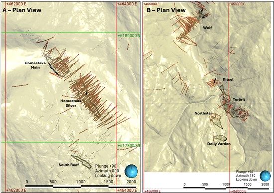
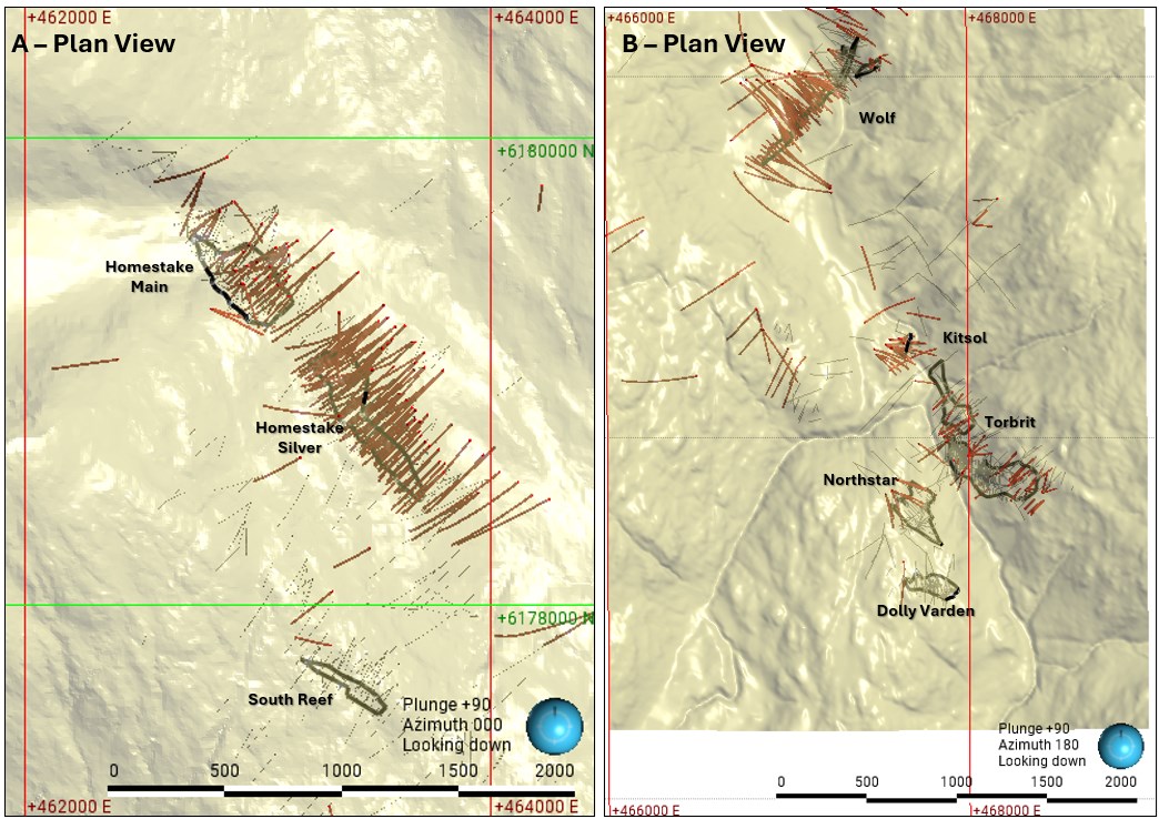
Figure 2. Drilling coverage supporting the mineral resource estimate. A: Homestake area. B: Dolly Varden area. Red traces identify drilling incorporated into the estimate.
To view an enhanced version of this graphic, please visit:
https://images.newsfilecorp.com/files/12610/315313_ce3a84810462786f_003full.jpg
Estimation Basis and Methodology
The seven updated deposits were modeled in Leapfrog Geo (version 2026.1.2 with the Edge extension) using hard geological boundaries with domain- and element-specific compositing and grade capping. Grade interpolation was executed using inverse-distance-cubed weighting with Leapfrog declustering applied by domain and element. The block model utilizes 5 m × 5 m × 5 m parent blocks with minimum sub-blocks of 0.5 m × 0.5 m × 0.5 m in NAD83 / UTM Zone 9N coordinates. Resource classification reflects the Qualified Person’s assessment of geological and grade continuity, data reliability, and drill-hole support, applying nominal Indicated and Inferred spacing limits tailored to each deposit. South Reef retains its historical estimation basis and is reported separately.
Price Inputs and Technical Assumptions
Silver-equivalent calculations incorporate variable metallurgical recovery assumptions across deposit groups and use commodity prices of US$53/oz Ag, US$3,500/oz Au, US$5.00/lb Cu, US$1.25/lb Zn and US$0.90/lb Pb. Metallurgical recovery factors are integrated directly into the silver-equivalent formulas, with AgEq coefficients reflecting relative metal value rather than net payable revenue after commercial deductions.
The conceptual mining framework considers mechanized underground extraction, including longhole stoping where deposit geometry and ground conditions permit. Reporting constraints and the assessment of reasonable prospects for economic extraction account for site access, processing, marketability, infrastructure, environmental considerations, and permitting requirements. This resource-stage estimate does not establish project-level capital expenditures, definitive operating costs, a mine production schedule, net present value, or internal rate of return. Mineral resources are not mineral reserves and do not demonstrate economic viability. There are no mineral reserves for the Kitsault Valley Project.
Next Steps
The Company’s Qualified Person has recommended a structured, two-stage work program to advance Kitsault Valley:
Cautionary Note Regarding Mineral Resources
Mineral Resources are not Mineral Reserves and do not have demonstrated economic viability. No Measured Mineral Resources or Mineral Reserves are reported for the Kitsault Valley Project. The estimate is intended to support continued evaluation of potential underground extraction and does not establish a mine development decision. Indicated Mineral Resources have a lower level of confidence than Measured Mineral Resources, and Inferred Mineral Resources have a lower level of confidence than Indicated Mineral Resources; Inferred Mineral Resources cannot be assumed to be converted to Indicated or Measured Mineral Resources or to Mineral Reserves, and actual upgrading depends on future drilling, sampling, metallurgical, engineering, environmental, permitting and economic results and is not assured.
The mineral resource estimate is subject to material uncertainties including local geological and grade continuity, high-grade sample influence, historical data and mined-out geometry, density variability, metallurgical response and product quality, mining dimensions and ground conditions, access and infrastructure requirements, water and waste management, permitting, and commodity-price and operating-cost assumptions. This news release uses the term “silver-equivalent”; silver-equivalent figures are calculated using the metal price and recovery assumptions described in the Company’s technical report and do not represent recovered or payable metal or net smelter revenue after commercial deductions.
Data Verification and Qualified Person Conclusions
The estimate uses the accepted historical and modern drilling and assay database, incorporating all drilling through the completed 2025 program. The QP finalized, checked and certified the databases and supporting information on April 13, 2026, and accepted the final resource statement, classifications and supporting assumptions as complete and current on September 11, 2026. Historic drilling (pre-2011) was not used for resource estimation but was used to support geological modelling. Drilling completed in 2026 falls outside the accepted estimation dataset and is expected to be incorporated in the next MRE update.
Quality Assurance and Quality Control
Contango’s drilling, sampling and database verification programs are conducted under the supervision of the Company’s Qualified Person and in accordance with procedures intended to support disclosure under SEC Regulation S-K 1300. The QP’s verification included review of drilling, logging, sampling, survey and analytical procedures; selected comparisons of original drill logs and assay certificates against digital records; review of analytical quality control; and checks for overlapping intervals, records extending beyond hole depth, missing fields, inconsistent codes and unit-conversion errors.
The QP personally inspected the Project on September 14, 2025, and July 21-24, 2026, including review of core handling, logging, sampling and geological observations. Some historical assay certificates remain unavailable; those records were assessed using prior verification, internal consistency and comparison with surrounding drilling. The QP considers the accepted data adequate for the geological interpretation and mineral resource estimation purposes described in the technical report summary.
Conference Call and Webcast
Contango will host a conference call and webcast to discuss the Kitsault Valley Project MRE update with the Company’s CEO – Rick Van Nieuwenhuyse, President – Shawn Khunkhun, and Vice President, Exploration – Dave Larimer on Wednesday, September 23, 2026, at 1:00pm EST / 10:00am PST. Participants may join the webcast using the following call-in details: https://6ix.com/event/kitsault-mre-update.
Qualified Person
The scientific and technical information contained in this news release has been reviewed and approved by Dave Larimer, CPG, Vice President, Exploration of Contango. Mr. Larimer is a “qualified person” as defined in Subpart 1300 of Regulation S-K and National Instrument 43-101. Mr. Larimer is an employee of, and is not independent of, the Company. Mr. Larimer holds American Institute of Professional Geologists certification CPG-11862 and State of Alaska Certified Professional Geologist certification 115316, both in good standing.
ABOUT CONTANGO
Contango is an NYSE American and the Toronto Stock Exchange listed company, with gold and associated mineral production in Alaska and gold, silver and associated mineral exploration and development projects in Alaska and the Golden Triangle in British Columbia. Contango holds a 30% interest in the Peak Gold JV, which leases approximately 675,000 acres of land in Alaska, including the production of Manh Choh mine, with the remaining 70% owned by KG Mining (Alaska), Inc., an indirect subsidiary of Kinross Gold Corporation, operator of the Peak Gold JV. KG Mining (Alaska), Inc. serves as the manager of the Peak Gold JV.
The Company and its subsidiaries also have (i) a lease on the Johnson Tract project, which consists of mineral rights to approximately 21,000 acres located near tidewater, 125 miles southwest of Anchorage, Alaska, from the underlying owner, CIRI, (ii) a lease on the Lucky Shot project, which consists of mineral rights to approximately 8,600 acres of State of Alaska and patented mining claims located in the Willow Mining District about 75 miles north of Anchorage, Alaska, from the underlying owner, Alaska Hardrock Inc., (iii) mineral rights to approximately 145,000 acres of State of Alaska mining claims, (iv) mineral rights to approximately 11,700 acres of State of Alaska mining claims and upland mining leases, and (v) mineral tenures of approximately 247,000 acres (100,000 ha) located in and around the Kitsault Valley in the Golden Triangle of northwest British Columbia. These interests confer exploration and development rights, subject to applicable agreements, laws, permits and approvals.
Additional information can be found on the Company’s website at www.contangoore.com.
Brutus Mining Inc. (CSE: BRU) (FSE: ZI3) is pleased to announce that it has closed its non-brokered ... READ MORE
Jaguar Uranium Corp. (NYSE American: JAGU) is pleased to announce an independent Mineral Resource E... READ MORE
Auro Metals Inc. (TSX-V: AURO) (OTCQB: AURFF), is pleased to announce the assay results of the fina... READ MORE
Endeavour Silver Corp. (NYSE: EXK) (TSX: EDR) is pleased to announce that repairs to the primary bal... READ MORE
Scorpio Gold Corp. (NASDAQ: SGLD) (TSX-V: SGLD) (OTCQB: SRCRF) (FSE: RY9) is pleased to announce re... READ MORE